

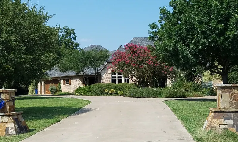
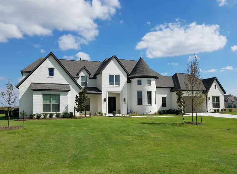
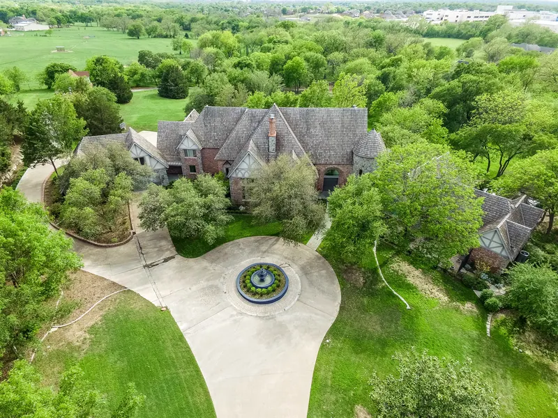
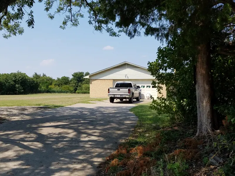
How to read Parker's neighborhoods
Nearly every residential lot in Parker falls into one of four zoning categories on the city's official zoning map (Ordinance 827, adopted September 20, 2022). Knowing the category tells you most of what you need to know about lot size and setbacks.
| Zoning | Minimum lot | Other key standards |
|---|---|---|
| SF, Single Family Residential | 2.0 acres net (87,120 sq ft) | 200 ft frontage, 300 ft depth, 100 ft front setback, 40 ft side, 50 ft rear |
| SFT, Single Family Transitional | 1.0 acre, with a 1.5-acre average | Setbacks scale with lot size; closed to new applications |
| A-O, Agricultural and Open Space | 5 acres in contiguous tracts | Farms, pasture, barns, stables, single-family homes |
| PRD and DA | Set by the planned development ordinance or developer agreement | Used for Parker Lake Estates and Kings Crossing |
SF and SFT homes must have at least 2,500 square feet of air-conditioned space. At least 90 percent of the first floor exterior and 75 percent of the total elevation must be brick, stone, or approved masonry, not counting doors and windows. Several subdivisions were platted before the 1987 comprehensive zoning ordinance or under earlier rules, so their actual lots can be smaller than today's minimums.
About the figures on this page
The numbers below come from the Collin Central Appraisal District parcel layer with 2026 certified values, downloaded October 12, 2026. They cover improved single-family parcels inside Parker city limits: 2,042 homes, including 72 homes on acreage parcels that the district codes as farm and ranch homesites. Phases are grouped under one subdivision name.
- Lot size is the median, with the 10th to 90th percentile range so that a few unusual parcels do not distort the picture.
- Year built is the median, with the 10th to 90th percentile range.
- Values are 2026 certified market values (appraisal), not sale prices. Homes built in 2025 and 2026 often carry a partial value from the January 1 appraisal date, so value figures use homes built through 2024.
- School district counts come from the district each parcel is taxed by. Boundaries split some subdivisions, so confirm any address with the district's own locator.
The zoning dates below come from the ordinance table printed on the zoning map. A zoning date marks when a tract was zoned for its current use. Homes were often built years later.
Parker by the numbers (2026 appraisal roll)
| Measure | Figure |
|---|---|
| Single-family homes in city limits | 2,042 |
| Median lot | 1.18 acres (10th to 90th percentile: 0.97 to 2.50) |
| Homes on 1 acre or more | 1,789 (87.6 percent) |
| Homes on 2 acres or more | 503 (24.6 percent) |
| Homes on 5 acres or more | 63 |
| Median year built | 2007 |
| Median living area | 4,512 sq ft |
| Homes with a pool | 1,071 (52.4 percent) |
| Median 2026 certified market value (appraisal) | about $1.19 million (homes built through 2024) |
| School district by home count | Plano ISD 1,333 (65.3%), Allen ISD 699 (34.2%), Wylie ISD 10 (0.5%) |
Allen ISD covers only about 18.5 percent of Parker's land, but because its northern band holds several of the denser subdivisions, it serves about a third of the city's homes.
Subdivision summary
| Subdivision | Location | Homes | Median lot (ac) | Lot range (ac) | Median built | Median 2026 value | Value range | ISD (homes) |
|---|---|---|---|---|---|---|---|---|
| Parker Lake Estates | North, east of Dillehay Dr | 277 | 0.66 | 0.53 to 1.09 | 2002 | $0.93M | $0.82M to $1.05M | Allen 254, Plano 23 |
| Kings Crossing | Northeast, Lewis Ln | 209 | 1.01 | 1.00 to 1.31 | 2019 | $1.49M | $1.29M to $1.89M | Allen 173, Plano 36 |
| Parker Ranch Estates | Northwest, Chaparral Rd | 207 | 1.49 | 1.16 to 2.25 | 2019 | $1.49M | $1.33M to $1.73M | Allen |
| Whitestone Estates | North-central, west of FM 2551 | 207 | 1.10 | 1.01 to 1.57 | 2022 | $1.46M | $1.21M to $1.88M | Plano |
| Southridge (all sections) | North-central, east of FM 2551 | 152 | 1.03 | 1.00 to 1.25 | 2013 | $1.13M | $1.00M to $1.26M | Plano |
| Springhill Estates | West side | 82 | 1.45 | 1.00 to 2.01 | 1999 | $0.82M | $0.65M to $1.43M | Plano |
| Dublin Road Estates | South end, Dublin Rd | 78 | 1.37 | 1.03 to 2.17 | 2003 | $1.32M | $1.01M to $1.80M | Plano |
| Brooks Farm Estates | East of FM 2551, south of Parker Rd | 71 | 1.24 | 1.00 to 2.14 | 2009 | $1.38M | $1.07M to $1.84M | Plano 65, Wylie 6 |
| Knolls of Springhill | Far northwest | 60 | 1.14 | 0.97 to 2.79 | 2002 | $1.14M | $0.84M to $1.38M | Plano 32, Allen 28 |
| Easy Acres | North-central, west of Dillehay Dr | 59 | 0.97 | 0.97 to 0.98 | 1973 | $0.44M | $0.40M to $0.47M | Plano |
| McCreary Creek Estates | East side | 59 | 1.00 | 1.00 to 1.64 | 2012 | $1.59M | $1.39M to $2.04M | Plano |
| Kingsbridge | Far east, near Bois D'Arc Ln | 52 | 1.20 | 1.17 to 2.12 | 2020 | $1.45M | $1.33M to $1.78M | Plano 49, Wylie 3 |
| Moss Ridge Estates | East side | 50 | 2.04 | 1.92 to 2.23 | 1993 | $1.00M | $0.89M to $1.23M | Plano |
| Windmill Country Estates | West-central, north of Parker Rd | 41 | 2.06 | 1.95 to 2.25 | 1980 | $0.77M | $0.60M to $1.23M | Plano |
| Cottonwood Acres North | West-central, north of Parker Rd | 35 | 2.01 | 1.97 to 2.21 | 1971 | $0.70M | $0.62M to $0.87M | Plano |
| Cottonwood Acres | South of Parker Rd, west side | 35 | 2.50 | 2.02 to 5.03 | 1972 | $0.86M | $0.75M to $1.66M | Plano |
| Parker Village | North, Corinth Chapel Rd | 33 | 1.00 | 1.00 to 2.00 | 2006 | $0.97M | $0.91M to $1.17M | Allen |
| Poco Estados | North of E. Parker Rd, east side | 32 | 1.77 | 1.74 to 1.90 | 1977 | $0.65M | $0.58M to $0.77M | Plano |
| Dublin Park Addition | Dublin Rd, north of Betsy Ln | 30 | 1.00 | 1.00 to 2.00 | 2001 | $1.00M | $0.87M to $1.22M | Plano |
| Dublin Creek Estates | West of Dublin Rd | 28 | 3.04 | 2.00 to 4.11 | 1999 | $1.91M | $1.49M to $3.01M | Plano |
| Springhill Farms | West side | 20 | 2.00 | 1.24 to 2.04 | 1997 | $1.05M | $0.79M to $1.35M | Plano |
| Sycamore Estates | West side | 15 | 4.35 | 3.00 to 4.39 | 1984 | $1.14M | $0.94M to $1.53M | Plano |
| Ranchview Estates | Central, off Gregory Ln | 11 | 1.84 | 1.83 to 2.27 | 1973 | $0.66M | $0.42M to $0.69M | Plano |
| Unplatted acreage (survey tracts) | Scattered | 134 | 3.00 | 1.07 to 10.16 | 1975 | $0.93M | $0.44M to $2.54M | Plano 129, Allen 4, Wylie 1 |
Values are 2026 certified market values (appraisal), in millions of dollars, with ranges at the 10th and 90th percentiles. Lot and value ranges use the same percentiles.
North Parker: the Allen ISD band
The north end of Parker, roughly between the Corinth Chapel and Curtis Road area and Lucas Road, lies mostly in Allen ISD. It holds the city's densest platting and much of its recent construction.
Parker Lake Estates
Parker Lake Estates sits east of Dillehay Drive (FM 2551) and south of Lucas Road. Phase I was zoned as a Planned Residential Development in 1999 and Phase II in 2005. Phases 3-A and 3-B extend south toward Andover Drive and Bracknell Drive under SFT zoning. Streets include Hathaway Drive, Glenmore Drive, Overton Drive, Rathbone Drive, Ridgemore Drive, Dunnaway Crossing, Corsham Drive, and Englenook Drive.
- 277 homes, the largest subdivision in Parker
- Lots: about 0.6 acres in Phases I and II under the planned development terms, and about 1.0 acre in Phases 3-A and 3-B; median 0.66 acres overall
- Built: 2000 to 2005 for most homes (median 2002)
- Median 2026 certified market value (appraisal): about $930,000, with most between $820,000 and $1.05 million
- Median living area: about 4,000 sq ft; 69 percent have a pool
- School district: Allen ISD for 254 homes. Part of Phase 3-B, including homes on Englenook Drive, Dumont Court, and part of Ravensthorpe Drive, is in Plano ISD (23 homes).
Kings Crossing
Kings Crossing occupies the northeast corner of the city along Lewis Lane, Middleton Drive, Westfield Drive, Stafford Drive, Holbrook Circle, and Cheswick Court. Phase I was zoned in 2007 and Phase II in 2015, and the 2022 zoning map shows a large developer-agreement block between Parker Lake Estates and Kings Crossing.
- 209 homes across six phases, built from 2014 on (median 2019)
- Lots: about one acre (10th to 90th percentile: 1.00 to 1.31)
- Median 2026 certified market value (appraisal): about $1.49 million, with most between $1.29 million and $1.89 million
- Median living area: about 5,450 sq ft; 51 percent have a pool
- Still building: Phase 5 homes went up mainly in 2025, and Phase 6 (Camden Court, Mayfair Lane, Sutton Street, Stoneleigh Way) had its first four homes on the 2026 roll and 40 vacant lots.
- School district: Allen ISD for Phases 1, 2, 4, 5, and 6 (173 homes). Phase 3, built mostly in 2022 and 2023 on Canterbury Court, Dover Drive, and Sudbury Circle, is in Plano ISD (36 homes).
Parker Ranch Estates
Parker Ranch Estates sits in the northwest along Chaparral Road (County Road 993), with streets including Salisbury, Barrington, Berwick, Fulbrook, Kirkdale, Whisper Drive, Keswick Drive, and Ivybridge Drive. Parker Ranch III and IV were zoned SFT in 2003, and Parker Ranch II, south of Chaparral Road, is zoned SF. Bolin Elementary, an Allen ISD campus, sits on the north edge of the subdivision.
- 207 homes in six phases, built from 2016 on (median 2019)
- Lots: median 1.49 acres; Phases 2 and 5 have the largest lots, at medians of 2.25 and 2.01 acres
- Median 2026 certified market value (appraisal): about $1.49 million, with most between $1.33 million and $1.73 million
- Median living area: about 5,100 sq ft; 32 percent have a pool
- Still building: Phase 5 homes date from 2024 to 2026, with 10 vacant lots on the 2026 roll
- School district: Allen ISD for every home
Parker Village and Cox Farm Estates
These SFT sections lie east of Dillehay Drive between Corinth Chapel Road and Andover Drive, next to Parker Lake Estates, along Parker Village Drive, Eastgate Lane, and Cox Farm Estates. The appraisal district groups them as the Parker Village Addition: 33 homes on lots of about one acre, all built from 2005 to 2007, with a median 2026 certified market value (appraisal) of about $970,000. School district: Allen ISD.
The Knolls of Springhill
At the far northwest corner, along Rolling Knolls Drive, Shady Knolls Drive, Glen Meadows Drive, Copperhill Circle, and Willow Point Circle, the Knolls of Springhill was zoned SF in 1998. Its 60 homes date mostly from 1999 to 2004 on lots with a median of 1.14 acres, and the median 2026 certified market value (appraisal) is about $1.14 million. The district line runs through it: 28 homes are in Allen ISD, mainly on Rolling Knolls Drive, and 32 are in Plano ISD, mainly on Shady Knolls Drive, Glen Meadows Drive, and Lost Hollow Court.
North-central Parker: Plano ISD
Southridge
Southridge lies north of Parker Road and east of FM 2551. Its original sections were zoned SFT in 2005, and the appraisal district now lists four parts:
| Section | Homes | Built | Main streets |
|---|---|---|---|
| Southridge Estates, Phase 1 | 38 | 2006 to 2014 | Southridge Parkway, Ravensthorpe Drive, Northridge Parkway |
| Southridge Estates, Phase 2 | 55 | 2008 to 2018 | Northridge Parkway, Southridge Parkway, Vista Ridge, Meadow Ridge |
| Southridge East | 39 | 2016 to 2019 | Erin Lane, Bryce Drive |
| Reserve at Southridge | 20 | 2021 to 2026 | Laila Drive, Frenzel Drive |
Across all 152 homes, lots are about one acre and the median 2026 certified market value (appraisal) is about $1.13 million. The Reserve at Southridge, the newest section, has a median of about $1.52 million and 11 vacant lots on the 2026 roll. All Southridge homes are in Plano ISD (Hunt Elementary, Murphy Middle, McMillen High, Plano East Senior High). Ravensthorpe Drive has been part of the FM 2551 discussion: the city reported in October 2026 that it is exploring a possible permanent closure of the north entrance with the Southridge HOA and TxDOT, with no final plan.
Whitestone Estates
West of FM 2551 and north of Donihoo Lane, Whitestone Estates runs along Whitestone Drive, Donna Lane, Kingston Court, Cheshire Lane, Devon Drive, Belvedere Drive, Somerset Drive, Lincoln Lane, and Berkshire Drive. The zoning map shows the Whitestone II area zoned SFT in 2015.
- 207 homes in four phases, built from 2017 on (median 2022), which makes Whitestone the newest large subdivision in Parker
- Lots: median 1.10 acres (10th to 90th percentile: 1.01 to 1.57)
- Median 2026 certified market value (appraisal): about $1.46 million, with most between $1.21 million and $1.88 million
- Median living area: about 5,050 sq ft
- Still building: Phase 5 added 62 homes from 2024 to 2026 and still had 25 vacant lots on the 2026 roll
- School district: Plano ISD for every home. Kingston, Cheshire, and Belvedere are zoned to Hickey Elementary, Bowman Middle, Williams High, and Plano East Senior High. Homes on the north end of Whitestone Drive that belong to Parker Ranch Estates Phase 5 are in Allen ISD.
Easy Acres and Curtis Road
Easy Acres, on Elisa Lane and Kara Lane west of Dillehay Drive, is one of Parker's oldest platted subdivisions. Its 59 homes were built mostly from 1971 to 1979 on lots of about 0.97 acres, with a median living area of about 2,100 sq ft and a median 2026 certified market value (appraisal) of about $440,000. The zoning map shows it in the SF district under the 1987 comprehensive zoning. Small SF tracts around Curtis Road and Frenzel Drive near FM 2551 were zoned in 2000. School district: Plano ISD.
Poco Estados
Poco Estados sits north of East Parker Road on the east side of the city, along Estados Drive and Poco Drive. It has 32 homes on lots of about 1.75 acres, built mostly from 1974 to 1997 (median 1977), with a median 2026 certified market value (appraisal) of about $650,000. School district: Plano ISD.
West Parker: Springhill and Cottonwood
The west side has some of Parker's oldest platted acreage, much of it zoned SF under the 1987 comprehensive ordinance.
- Springhill Estates (Phases I to III): along Springhill Estates Drive, Willow Ridge Drive, Boulder Drive, Red Oak Circle, and Pecan Bend. 82 homes built mostly 1997 to 2004 on lots with a median of 1.45 acres; median 2026 certified market value (appraisal) about $820,000. Sycamore Branch runs through the area, and a strip along Crepe Myrtle Hill is zoned A-O.
- Springhill Farms: along Pecan Orchard Drive, Hackberry Lane, and Golden Pond Circle. 20 homes built mostly 1996 to 1999 on lots with a median of 2 acres; median about $1.05 million.
- Sycamore Estates: 15 homes on Hackberry Lane, Pecan Orchard Drive, and Springhill Estates Drive with a median lot of 4.35 acres, the largest platted lots on the west side. Median about $1.14 million.
- Windmill Country Estates: between Donihoo Lane and Parker Road, around Countryside Drive, Windmill Creek Drive, and Old Gate Lane. 41 homes on lots of about 2 acres, built mostly 1975 to 1992; median about $770,000. The zoning map labels this area, together with Cottonwood Acres North, as Cottonwood North.
- Cottonwood Acres North: next door around Cimmaron Circle, Wagon Wheel Drive, and Donna Lane. 35 homes on lots of about 2 acres, most built in the 1970s; median about $700,000.
- Cottonwood Acres: south of Parker Road along Saddle Trail and Ridgeview Drive. 35 homes on lots with a median of 2.5 acres and a median year built of 1972, with some newer homes mixed in; median about $860,000. The zoning map labels this area Cottonwood South.
Private drives such as Windream Lane and Anns Lane are noted on the zoning map. School district: Plano ISD (Hickey, Bowman, Williams) for these areas.
South Parker: Dublin Road corridor
Dublin Road runs south from Parker Road to the city's southern tip near Murphy. Homes at the south end carry the 75094 ZIP code.
Dublin Creek Estates
West of Dublin Road, along Dublin Creek Lane, Dublin Creek Circle, and Bluffs Lane, this SF area backs onto Cottonwood Creek. The appraisal district lists 28 homes, including 11 in the section platted as "The Bluffs."
- Lots: median 3.04 acres, every lot at least 2 acres
- Built: mostly 1994 to 2006 (median 1999)
- Median 2026 certified market value (appraisal): about $1.91 million, the highest of any Parker subdivision with more than 10 homes; 12 homes are valued at $2 million or more
- Median living area: about 5,800 sq ft
Nearby, Cottonwood Ridge on Ridgeview Drive (5 homes, median 3.4 acres) and the Reserve at Parker on Reserve Court (7 homes on two-acre and larger lots, built 2010 to 2021) are small enclaves with similar land. School district: Plano ISD (Hickey, Bowman, Williams).
Dublin Park Addition
North of Betsy Lane, on Mary Court and Dublin Park Drive, Dublin Park is a small SFT section bordered by A-O land on three sides. Its 30 homes were built from 2000 to 2002 on lots of about one acre, with a median 2026 certified market value (appraisal) of about $1.00 million. School district: Plano ISD (Hunt, Murphy Middle, McMillen).
Dublin Road Estates
Dublin Road Estates was built out in phases at the south end of the city. Phase II was zoned SF in 1998, Phases IV and V in 1999, and Phase VI was zoned SFT in 2001. Streets include Estate Lane, Creekside Court, Edgewater Court, Virginia Place, Ricks Court, Ramsey Court, and Parrant Court, with Mahaney Road and St. Lawrence Court nearby. The appraisal district lists Phase V as Dublin Park Estates.
- 78 homes, built mostly 1992 to 2009 (median 2003)
- Lots: median 1.37 acres (1.03 to 2.17)
- Median 2026 certified market value (appraisal): about $1.32 million
- School district: Plano ISD (Boggess Elementary, Murphy Middle, McMillen High, Plano East Senior High)
Central and East Parker
Gregory Lane, Gray Lane, and Hogge Road
The land between Parker Road, Gregory Lane, and Boseman Road is a mix of SF lots and large A-O tracts. Maxwell Creek runs through it, and the city's Preserve is on Gray Lane. Much of this land is not in a platted subdivision, and the appraisal district lists such tracts by their original land survey. Ranchview Estates, off Gregory Lane, is a small 1972 to 1973 subdivision of 11 homes on lots of about 1.8 acres. Southfork Ranch is on Hogge Road. School district: Plano ISD (Hunt, Murphy Middle, McMillen).
Brooks Farm Estates
East of FM 2551 and south of Parker Road, Brooks Farm Estates covers Overbrook Drive, Greenhill Court, Stony Oak Court, Margaux Drive, and Audubon Drive. It was zoned SFT in 2001, with the adjoining Brooks property added in 2005. The city calendar lists a Brooks Farm HOA National Night Out event.
- 71 homes, built mostly 2006 to 2014 (median 2009)
- Lots: median 1.24 acres
- Median 2026 certified market value (appraisal): about $1.38 million; 75 percent have a pool
- School district: Plano ISD (Hunt, Murphy Middle, McMillen) for 65 homes. Six homes on Audubon Drive are taxed by Wylie ISD.
Moss Ridge Estates
Moss Ridge Estates, on the loop of Moss Ridge Road and Moss Ridge Circle and along McCreary Road, dates to the 1987 zoning and carries SF two-acre zoning. Its 50 homes sit on lots with a median of 2.04 acres and were built mostly from 1986 to 1998 (median 1993). The median 2026 certified market value (appraisal) is about $1.00 million. School district: Plano ISD (Hunt, Murphy Middle, McMillen).
McCreary Creek Estates
South of Moss Ridge, along Forest Bend Drive and Meadow Glen Drive, McCreary Creek Estates was zoned SFT in 2006. Its 59 homes were built from 2007 to 2015 on lots of about one acre. With a median living area of about 5,400 sq ft, it has the highest median 2026 certified market value (appraisal) of Parker's one-acre subdivisions, about $1.59 million, and seven homes at $2 million or more. School district: Plano ISD (Hunt, Murphy Middle, McMillen).
McCreary Meadows
A new subdivision near East Parker Road and McCreary Road, along Gladys Drive, Leslie Lane, Zada Beth Court, and Martha Joyce Drive. The 2026 roll shows four homes with a 2026 year built and 35 vacant lots of about one acre. School district: Plano ISD.
Kingsbridge (Windomere and Nocona area)
At the city's eastern edge, near Bois D'Arc Lane, an SFT section zoned in 2001 includes Windomere Drive, Nocona Drive, Nancy Drive, Elaine Drive, Jeffrey Drive, and Natalie Court. The appraisal district lists it as Kingsbridge, Phases I and II. An A-O tract along Bois D'Arc Lane separates it from Parker Road.
- 52 homes, built mostly 2016 to 2022 (median 2020)
- Lots: median 1.20 acres
- Median 2026 certified market value (appraisal): about $1.45 million
- Mailing addresses use the 75098 ZIP code
- School district: Plano ISD for 49 homes; three homes on Jeffrey Drive are taxed by Wylie ISD
Acreage outside the subdivisions
Of Parker's 2,042 homes, 134 sit on unplatted survey tracts rather than in a named subdivision. These are the city's true acreage properties: the median parcel is 3.0 acres, 104 are 2 acres or larger, and the 10th to 90th percentile runs from about 1 acre to 10 acres. The median home was built in 1975, but the group ranges from farmhouses to recent estates. Their median 2026 certified market value (appraisal) is about $930,000, with a wide spread ($440,000 at the 10th percentile, $2.54 million at the 90th). Eighteen are valued at $2 million or more. Most are along Dublin Road, Sycamore Lane, East Parker Road, Gregory Lane, Dillehay Drive, and Smith Road, and nearly all are in Plano ISD.
The appraisal district also lists 69 parcels inside the city, covering about 925 acres, as qualified agricultural land.
Land outside the city limits
Several areas near Parker are not in the city, including Lonesome Dove Estates and the Shepherds Creek Addition near Lewis Lane, both shown outside the boundary on the 2022 zoning map. Homes outside the city limits are not covered by Parker zoning, and Parker water service only reaches a few streets in Wylie.
The appraisal district lists 37 parcels, about 358 acres, with Parker mailing addresses that are outside any city's limits. They include 9 homes (median lot about 2.2 acres, median 2026 certified market value (appraisal) about $645,000), 13 agricultural parcels, and a few commercial and exempt properties. They are scattered along East Parker Road near Lewis Lane, Curtis Drive, McWhirter Road, Hackberry Lane, and the south end of Dublin Road. The homes are in Plano ISD. The reverse also happens: 54 homes inside Parker city limits show Allen or Lucas as the city in their property address, so check the appraisal record and the city limits rather than the address alone.
East of FM 2551, the 103-acre Restore the Grasslands tract, with a proposed Collin County Municipal Utility District No. 7, is outside Parker's limits except for about 1.4 acres. The city reported in 2026 that it was negotiating with the developer and that litigation over that small piece was filed in September 2026. See the new construction page for the current status.
Sources (12)
- Collin Central Appraisal District parcel layer, 2026 certified values (hosted by the City of Allen GIS)
- City of Parker Zoning Map, Ordinance 827 (2022)
- Parker Code of Ordinances, Section 156.31 A-O District
- Parker Code of Ordinances, Section 156.32 SF District
- Parker Code of Ordinances, Section 156.33 SFT District
- Plano ISD School Finder and 2025-26 attendance zone map
- Plano ISD attendance boundary descriptions
- U.S. Census Bureau TIGERweb school district boundaries
- City of Parker: FM 2551 Project FAQ
- City of Parker: Restore the Grasslands Transparency
- City of Parker: New Service
- City of Parker homepage calendar
Last reviewed October 2026. See something out of date? Email info@grisak.com.
 Things to do
 Restaurants
 Luxury homes
 Homes we have sold